Shared mountains, shared future
Millions of people depend on water that springs from the high-mountain headwaters of Central Asia. Its towering peaks are home to the endangered snow leopard, ancient cultures, and landscapes that are being too quickly transformed by climate change. We are working to maintain high mountain headwater areas through conserving critical ecosystems that include snow leopard habitat, and assisting local communities as they adapt to climate-driven changes to their water supplies. This interconnected climate-water-wildlife approach is novel, and it is the first time comprehensive, coordinated, climate-smart conservation is being implemented across the vast range of snow leopard habitat.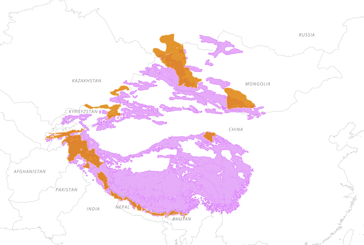
- GSLEP Landscapes Areas
- Potential Snow Leopard Habitat
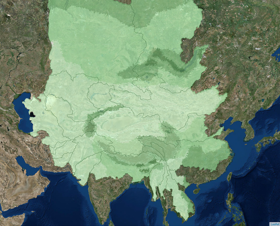
The Snow Leopard Range
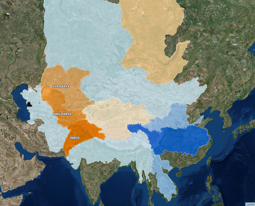
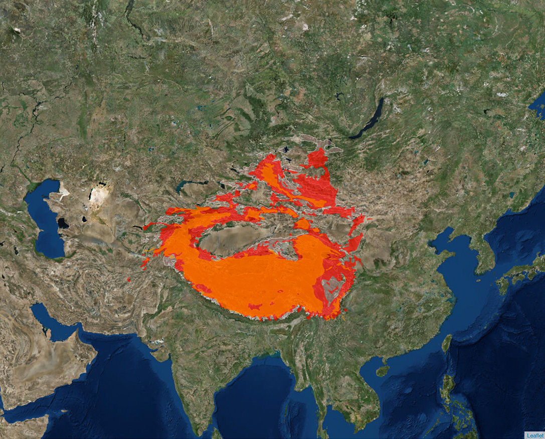
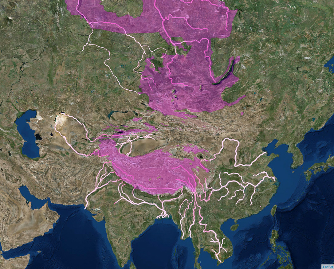
Although each range within Asia's high mountains has its own climate patterns and vulnerabilities, examining the snow leopard habitat at large reveals some common trends and provides a general overview of the region's threats and opportunities.Water Cycle
Precipitation in mm
- 0
- 50
- 100
Water Provision
Added Value - Water services in millions of people
- 0
- 50
- 100
People in positive "Added Value" basins (shown in shades of orange) rely disproportionately on water originating from the snow leopard range. Those people found in negatively ranked "Value Added" basins are more reliant on water originating from other parts of the basin (shown in shades of blue) strategy.
Climate envelope
- No Projected Change
- Potential Habitat Loss
Upstream influence of Permafrost
Upstream percentage
- 0
- 50
- 100
Increased Aridity under 2ºC Temperature Rise
Percent change
- 0
- 50
- 100
Tracking the Snow Leopard
Some features of the ranging pattern of snow leopards in the Kangchhenjunga Conservation Area of Nepal(Based on satellite telemetry data from 2 snow leopards, Lapchemba and Ghanjenjemba)
Male: 960 sqkm
Sub adult female: 2570 sqkm
Nearly 25 percent of overlap of home range between the two snow leopards
Elevation used:
Highest point: 5859 m -> Probably the highest elevation recorded for any wild cats of the world.
Daily distance travelled:
Annual average: 5.1 km/day -> shorter in summer (4.1 km/day) and longer in autumn (5.5 km/day)
Transboundary movement:
Frequent travels to India and China via mountain passes (movement corridors)
Kill rate:
One kill every 10 to 15 days.
- Kangchenjunga Conservation Area
- Lapchemba
- Ghanjenjwenga
Male: 960 sqkm
Sub adult female: 2570 sqkm
Nearly 25 percent of overlap of home range between the two snow leopards
Elevation used:
Highest point: 5859 m -> Probably the highest elevation recorded for any wild cats of the world.
Daily distance travelled:
Annual average: 5.1 km/day -> shorter in summer (4.1 km/day) and longer in autumn (5.5 km/day)
Transboundary movement:
Frequent travels to India and China via mountain passes (movement corridors)
Kill rate:
One kill every 10 to 15 days.
Gallery
-
A snow leopard walks through the Western Park Range of the Wangchuck Centennial National Park of Bhutan.
-
A female snow leopard and her two cubs walk through the forest in Bhutan.
-
Blue sheep (also known as bharal), are one of the snow leopard’s most important prey species.
-
Snow leopard scans his territory from a vantage point.
-
The snow leopard isn’t the only cat living in these high mountains. The Pallas Cat is much smaller than the snow leopard and just as illusive. These camera trap images provide the first photo-evidence of their presence in Bhutan.
-
Tibetan wolves roam across snow leopard habitat and like leopards, have been known to prey on livestock. WWF is working with communities to construct predator-proof corals, that would help keep livestock safe from leopards as well as other predators.
-
A snow leopard investigates the camera and takes a close up.
-
A snow leopard walks down a foot path used by people and their livestock.
-
Snow leopard tracks.
How to live together
Community ownership is central to conservation and adaptation work in the forbidding mountains of high Asia.This project strives to raise awareness of the issues threatening Asia’s high mountain communities and encourages local participation in solutions that benefits both people and nature.
Through site-specific interventions, we promote climate-smart actions that integrate sustainable development, water security, and snow leopard conservation. Activities emphasize building capacity of local governments, increasing public understanding, and providing incentives to ensure that communities are empowered to protect snow leopards and the ecosystems that help safeguard the headwaters of rivers upon which millions of people depend.